Firehouse Software St. Louis County, MO
 St. Louis County is located in Missouri's eastern-central region. It is bordered on the east by the City of St. Louis and the Mississippi River, on the north by the Missouri River, and on the south by the Meramec River. The population was just shy of one million people as of the 2019 Census Bureau population estimate, making it Missouri's most populous county.
Clayton is the county seat. The metropolitan statistical region of St. Louis, MO-IL encompasses the county. The county has a rich history dating back to the Eighteenth Century. From copious outdoor activity options to great healthcare and schools, there is plenty to love about living in the western portion of the St. Louis metropolitan area.
For firehouses in St. Louis County, protecting people and property in the area is paramount. StreetWise® is here to help.
StreetWise® Firehouse Software for St. Louis County
Previously, fire departments had to rely on software created mainly for police departments. The issue is that firefighters and paramedics require different information, drive larger vehicles, and each emergency is time-sensitive and can be a matter of life and death.
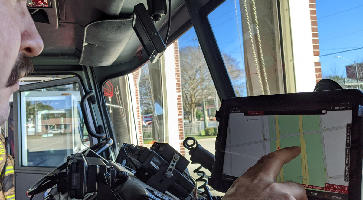
StreetWise is a comprehensive software suite tailored to the needs of fire and EMS departments. Finally, when it comes to mobile equipment software, you have an option made to suit your needs. You don't need to use police department software or a smartphone app developed for LEOs any longer.
A One-Stop Shop for Firehouse Software in St. Louis County, MO
Our program is developed for firefighters and paramedics and is a one-stop-shop for everything they need:
- Incident Preplan Management: Our preplan wizard assists you in gathering pre-incident data in a timely and effective manner that meets NFPA 1620 requirements.
- Mapping and Notifications: Calls received from a client's CAD to the StreetWise interface are immediately routed to the appropriate devices. The incident details are displayed in a full-screen, easy-to-read display that includes a call index.
- Navigation and Routing: Calls are instantly mapped and presented at the touch of a button. Google maps, satellite, and even street view choices are all integrated into our software.
- Instant Photo Sharing: Using the table's built-in camera, you can take a photo and share it without leaving the StreetWise app.
- Live Unit Locations: See other apparatus displayed on the tactical map in real-time for enhanced coordination. Labels display your vehicle's name as well as a number of icons for various types of equipment.
- Hydrant Display: Hydrants and water spots can be seen on the street map, terrain view, or aerial image view. Hydrant icons are interactive and can display information like flow capacity, primary size, and location notes.
- Shared Waypoints: StreetWise is more than simply a mapping program; it also provides you with creative new techniques to assist in incident management. With a simple tap of your finger, tactical waypoints can be dropped on the map and displayed on the maps of all other devices engaged in your conversation within seconds.
- Status Timestamp Log: Change and record your unit’s status, such as En Route, Arrived, Available, etc., at the push of a button. Unit status timestamps are instantly recorded in the server for later retrieval to enhance documentation of truly accurate response times.
Firehouses Trust StreetWise in St. Louis County
Here are a few of the areas in which departments have trusted StreetWise:
- Brentwood
- Clayton
- Maplewood
- Olivette
- Richmond Heights
- Shrewsbury
- University City
- Webster Grove
If you are ready to help your firehouse find the right software, contact the team at StreetWise today.